Trinity Metro Station
Trinity Metro Station
Consider the route someone using the metro would have to take from Trinity Metro Station to their place of work next to Aga Abbas Ali Road.
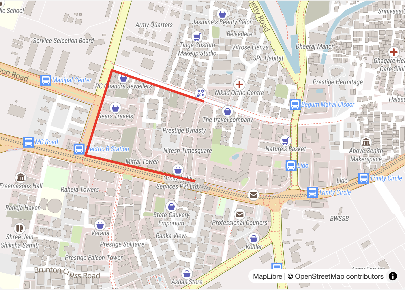
The current route is nearly 850m and circuitous
The distance as the crow flies is just 260m, or a 4-minute walk. On foot, Aga Abbas Ali Road is nearly 850m away. It is almost triple the distance, and outside what the DULT considers the “walkable” distance for commuters. Some companies along Halasuru Road offer private cab shuttle services to improve connectivity to the metro. Other commuters who can afford it use autos and cabs for the last mile. Others skip the metro entirely, since it may be cheaper or faster to simply take a cab, auto, or bike taxi for the end-to-end trip. The ideal fix would be to have a direct road from the metro itself, but is this possible in the heart of Bengaluru, where almost every site has already been developed into a building? Surprisingly, there is a lot of space available, since the building bylaws in Bengaluru require significant setbacks around all buildings. These setbacks typically create 6–13m of “undevelopable” land around buildings (depending on building height).
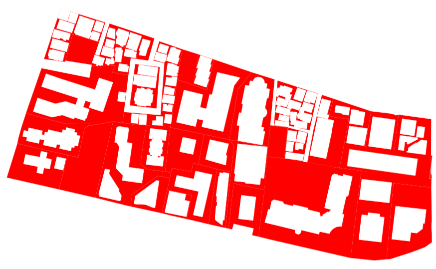
Setback space around the buildings, highlighted in red.
The image highlights the area the buildings cover on the ground versus the plot area. For this block, bounded by MG Road, Bhaskaran Road, Halasuru Road, and Dickenson Road, roughly 40% of the land is “open” space, or space that has not been built upon. Some of this space is still put to productive use. For example, the East Parade Church at the South Western corner uses the open area as a courtyard. There are also three hotels, which use the unbuilt area in their plots for recreation areas such as swimming pools and lawns. For many of these plots, though, the space is used as a “fire driveway” that envelopes the building. This is often just a flat concrete driveway that surrounds the building. It is often unpleasant and unused space. Removing the walls that divide some of these plots would immediately connect these driveways, and provide the space needed for a new road. This new road would provide a more direct and significantly shorter route from the metro station.
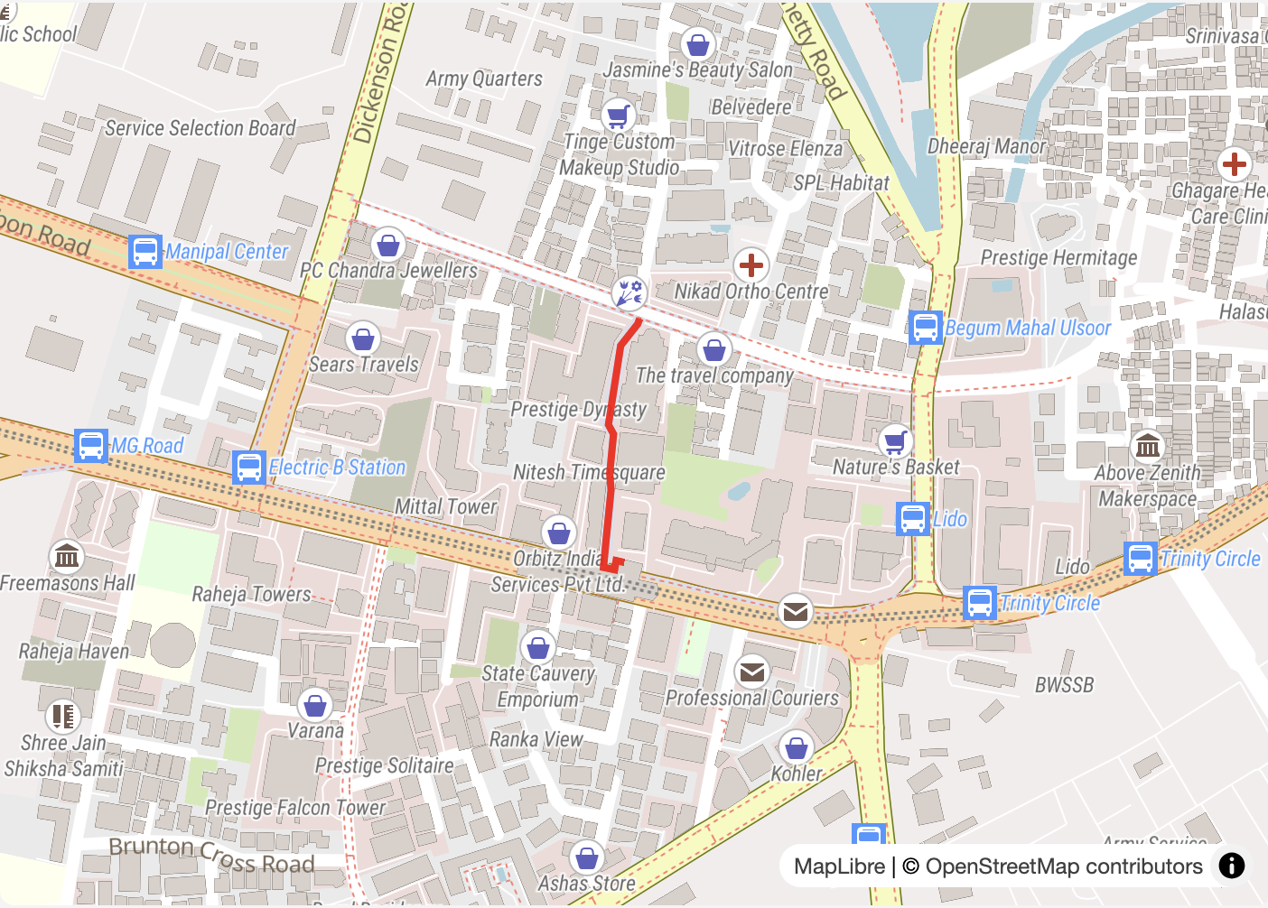
The new route is significantly shorter and more direct
It could be a quiet, traffic-free pedestrian-only street that connects Mahatma Gandhi Road and Halasuru Road. Vehicles could continue to use the same routes as before, along the existing road network; however, emergency vehicles could use it as a shortcut when needed. The more direct route would also help with perceptions of distance — more circuitous routes can feel more distant than they actually are, causing fewer people to walk and instead pick other modes. The improved walkability would also increase ridership, since it would be easier to get to and from the metro station.
The additional space on the new road could be used for planting trees and general greening. Some of the space could also be allocated to street vendors. This would reduce congestion on the narrower footpaths on Halasuru Road and Dickenson Road. Offices would no longer need to provide shuttle cabs from the metro for such short distances. BMTC could instead offer feeder buses for larger distances around the Trinity Metro Station area.
This would be a clear win for multiple stakeholders, but how can this be implemented? The first step would be to get it included in the master plan for the city. Bengaluru still operates on Regional Master Plan-2015, since RMP-2031 was not accepted. The Greater Bengaluru Authority has called for tenders for the new RMP. Similar roads can be planned around all metro stations. The land itself could be acquired from private landowners using Transferable Development Rights (TDRs) or Town Planning Schemes. The provision of additional FAR would also increase density in the immediate vicinity of the station, which would further boost metro ridership and improve transit accessibility.